
File:Liverpoolmap 1947.jpg
Size of this preview: 348 × 479 pixels.
| |
This is a file from the Wikimedia Commons. Information from its description page there is shown below.
Commons is a freely licensed media file repository. You can help. |
| Description |
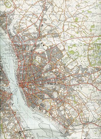
English: Reproduced from the 1947 OS map
|
| Date | 2006-08-16 (original upload date) |
| Source | Transferred from en.wikipedia; transfer was stated to be made by User:PC78. |
| Author | Original uploader was Geni at en.wikipedia |
| Permission ( Reusing this file) |
See license section. |
Licensing
 |
This work is in the public domain worldwide because it is an Ordnance Survey map over 50 years old. Ordnance Survey maps are covered by Crown Copyright which in this case expires 50 years after publication. Ordnance Survey does however ask that they be credited and that the date of publication be given. Any ancillary rights gained through the creation of the electronic version are granted as freely usable under any circumstances. |
File usage
The following pages on Schools Wikipedia link to this image (list may be incomplete):
Schools Wikipedia and SOS Children
Wikipedia for Schools was collected by SOS Children. SOS Children's Villages helps more than 2 million people across 133 countries around the world. Why not try to find out more about sponsoring a child?