
File:Map of the African Union with Suspended States.svg
Size of this preview: 480 × 480 pixels.
| |
This is a file from the Wikimedia Commons. Information from its description page there is shown below.
Commons is a freely licensed media file repository. You can help. |
| Description |
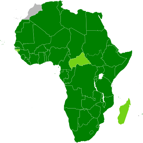
Deutsch: Karte Afrikas mit Mitgliedsstaaten der Afrikanischen Union in dunkelgrün und suspendierten Mitgliedern in hellgrün
English: Map of African, with African Union member states in dark green and states with suspended membership in light green
|
| Date | 17 August 2009. (17 August 2009 (original upload date)) |
| Source | Transferred from en.wikipedia (Original text : Based on information in the African Union article.) |
| Author | Patrick Braga. Original uploader was Theunixgeek at en.wikipedia |
| Permission ( Reusing this file) |
CC-BY-SA-3.0. |
Licensing
| This file is licensed under the Creative Commons Attribution-Share Alike 3.0 Unported license. | ||
|
File usage
The following pages on Schools Wikipedia link to this image (list may be incomplete):
Metadata
Find out more
You can learn about nearly 6,000 different topics on Schools Wikipedia. SOS Children is there for the children in our care until they are ready for independence. There are many ways to help with SOS Childrens Villages.