
File:Mongol Empire map.gif
Size of this preview: 610 × 479 pixels.
| |
This is a file from the Wikimedia Commons. Information from its description page there is shown below.
Commons is a freely licensed media file repository. You can help. |
Summary
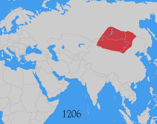
| Description | Map showing changes in borders of the Mongol Empire from founding by Genghis Khan in 1206, Genghis Khan's death in 1227 to the rule of Kublai Khan (1260–1294). (Uses modern day borders) Mongol Empire
By 1294 the empire had split into: Golden Horde
Chagatai Khanate
Ilkhanate
Yuan Dynasty (Great Khanate)
|
| Date | June 2006 |
| Source | Based on the freely licenced Image:Genghis khan empire at his death.png using information from maps of the Mongol Empire in atlases and on the web such as , , , , . Made in Photoshop and Painter. |
| Author | User:Astrokey44 |
| Permission ( Reusing this file) |
self made |
Licensing
|

Additional sources
- For the Ilkhanate: Roolvink, R. (2007) Historical Atlas of the Muslim Peoples, Taylor and Francis, p. 26 ISBN: 9780415440943.
- Mongol dominions, 1226–1405: Shepherd, William Robert; C.S. Hammond & Company (1964) Historical atlas, Barnes & Noble, p. 92
- McKitterick, Rosamond (2003) Atlas of the medieval world, Oxford University Press, pp. 174–175 ISBN: 9780195221589.
| Annotations | This image is annotated: View the annotations at Commons |
File usage
The following pages on Schools Wikipedia link to this image (list may be incomplete):
Learn more about Schools Wikipedia
Wikipedia for Schools is one of SOS Children's many educational projects. SOS Children's Villages is a global charity founded in 1949 to give children who have lost everything the childhood they deserve. Sponsoring a child is the coolest way to help.