
File:Kyrgyzstan topography.pdf
Size of this preview: 640 × 454 pixels.
| |
This is a file from the Wikimedia Commons. Information from its description page there is shown below.
Commons is a freely licensed media file repository. You can help. |
Contents |
Summary
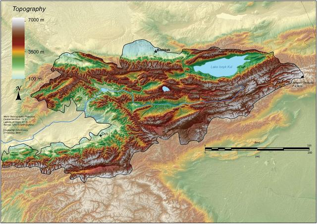
| Description |
English: A topographic map of Kyrgyzstan, labeling the two largest cities and the largest lake.
|
| Date | 23 November 2011 |
| Source | Own work |
| Author | Jemery |
Licensing
|
![]() The categories of this image should be checked. Check them now!
The categories of this image should be checked. Check them now!
- Remove redundant categories and try to put this image in the most specific category/categories
- Remove this template by clicking here (or on the first line)
File usage on other wikis
Related galleries
File usage
The following pages on Schools Wikipedia link to this image (list may be incomplete):
More information
All five editions of Schools Wikipedia were compiled by SOS Children's Villages. The world's largest orphan charity, SOS Children's Villages brings a better life to more than 2 million people in 133 countries around the globe. Have you thought about sponsoring a child?