
File:N&SAmerica-pol.jpg
Size of this preview: 318 × 479 pixels.
| |
This is a file from the Wikimedia Commons. Information from its description page there is shown below.
Commons is a freely licensed media file repository. You can help. |
This image was uploaded in the JPEG format even though it consists of non-photographic data. This information could be stored more efficiently or accurately in the PNG format or SVG format. If possible, please upload a PNG or SVG version of this image without compression artifacts, derived from a non-JPEG source (or with existing artifacts removed). After doing so, please tag the JPEG version with {{ Superseded|NewImage.ext}}, and remove this tag. This tag should not be applied to photographs or scans. For more information, see {{ BadJPEG}}. |
|
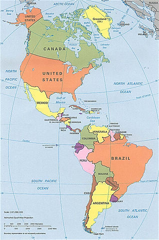
Summary
| Description |
Americas – North and South America |
| Date | 9 May 2001 (according to EXIF data) |
| Source | http://www.lib.utexas.edu/maps/americas/americas_pol96.jpg |
| Author | CIA, original political map from Perry-Castañeda Library Map Collection; University of Texas Library Online |
Licensing
 |
This work is in the public domain in the United States because it is a work prepared by an officer or employee of the United States Government as part of that person’s official duties under the terms of Title 17, Chapter 1, Section 105 of the US Code. See Copyright. Note: This only applies to original works of the Federal Government and not to the work of any individual U.S. state, territory, commonwealth, county, municipality, or any other subdivision. This template also does not apply to postage stamp designs published by the United States Postal Service since 1978. (See 206.02(b) of Compendium II: Copyright Office Practices). It also does not apply to certain US coins; see The US Mint Terms of Use. |
 |
|
|
||
File usage
The following pages on Schools Wikipedia link to this image (list may be incomplete):
I want to learn more...
Wikipedia for Schools was collected by SOS Childrens Villages. In 133 nations around the world, SOS Children works to bring better education and healthcare to families in desperate need of support. Help another child by taking out a sponsorship.