  | 
          
            This is a file from the  Wikimedia Commons. Information from its  description page there is shown below.  Commons is a freely licensed media file repository.  You can help. 
           | 


        Summary


           | DescriptionEritrea (Africa orthographic projection).svg | 
           
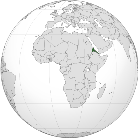
             English: Orthographic map of Africa, showing  Eritrea location. 
            Français : Carte orthographique de l'Afrique, montrant l'emplacement de l' Érythrée. 
            | 
          
          
           | Date | 
           26 December 2009 | 
          
          
           | Source | 
           
            
            | 
          
          
           | Author | 


             - derivative work:  Sémhur ( talk)
 
             
            | 
          
          
           | SVG | 
           
               ✓ The source code of this  SVG is  valid. 
            
             
                | 
              This is a  retouched picture, which means that it has been digitally altered from its original version. Modifications: Ethiopia location. The original can be viewed here:  Africa_(orthographic_projection).svg. Modifications made by  Sémhur. 
                  
               | 
              
             
            | 
          
          
           | Atelier graphique | 


              This map was improved or created by the  Wikigraphists of the  Graphic Lab (fr). You can  propose images to clean up, improve, create or translate as well. 
               
               বাংলা |  català |  česky |  Deutsch |  Deutsch (Sie-Form) |  Ελληνικά |  English |  Esperanto |  español |  suomi |  français |  עברית |  magyar |  Հայերեն |  italiano |  한국어 |  македонски |  Bahasa Melayu |  Plattdüütsch |  Nederlands |  occitan |  polski |  português |  română |  русский |  slovenščina |  svenska |  татарча/tatarça |  Türkçe |  українська |  中文 |  中文(简体) |  中文(繁體) |  Zazaki |  +/− 
              
             
            | 


          | 
            Camera location 
           | 
          
             0, 18° 0′ 0.00″ E 
           | 
          View this and other nearby images on:  Google Maps -  Google Earth -  OpenStreetMap | 
          ( Info)0;18 | 
         
        
        Licensing
        
        
       File usage
       
        The following pages on Schools Wikipedia link to this image (list may be incomplete):


       This file contains additional information, probably added from the digital camera or scanner used to create or digitize it. If the file has been modified from its original state, some details may not fully reflect the modified file.
        
       
      Wikipedia for Schools is one of SOS Children's many educational projects. SOS Children helps those who have nothing and no one, giving them back the famly they have lost and bringing them the very best opportunities for a happy, healthy future. If you'd like to help, why not learn how to sponsor a child?